
Route des Grandes Alpes III
From Briançon to the Vallée de l'Ubaye
We’re on the third stage of the Route des Grandes Alpes, a scenic touring itinerary following the mythical cols and valleys of the French Alps from Lac Léman to the Mediterranean sea. In this section we travel from the Briançon to the Vallée de l’Ubaye.
Some 340km from our starting point, we’re now half-way through our marathon 684km itinerary, a fact underlined by a gradual transition to the Mediterranean’s climatic influence.
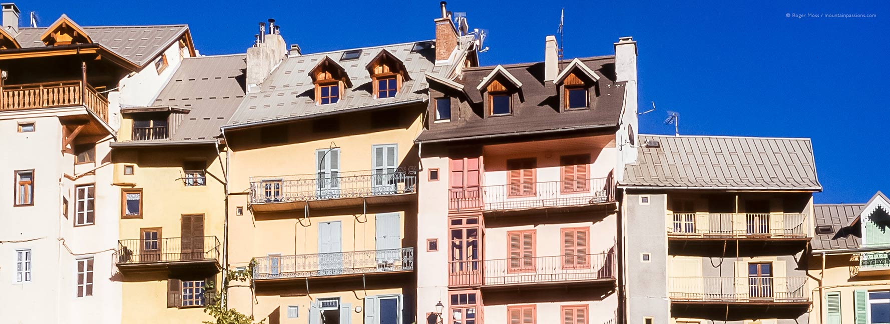
Leaving Europe’s second highest city, it’s tempting to assume that having made it this far the best senery must be behind us. Proof that this is certainly not the case comes as we pass tiny hamlets sitting among classic mountain scenery in the Cerveyrette valley. A little further along the valley we pass Cervières, a sheltered centre for peaceful, cross-country skiing (ski-de-fond) on pistes flanking the Italian border and which in other seasons become footpaths.
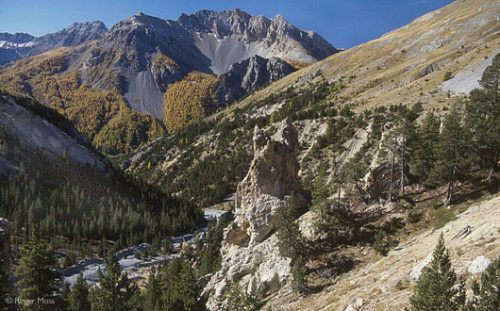
We now power our way up to the Col d’Izoard (2360m), the tortuous route climbing through dense forests of giant, multi-coloured conifers, beneath vast steel-blue skies.
For us it’s a startling vision of fiery golds and yellows, as whole mountainsides of larch woodland give their all in the late autumn sun.
A landscape for heroes…
Beyond the Col another hidden valley unfolds against the vast mountains of the Parc Natural Régional du Queyras. Considering the merciless gradients (and the fact that the road wasn’t surfaced until 1963), it’s hard not to be impressed by the heroism of those who tackled this gruelling Tour de France stage. At the roadside are memorials to Fausto Coppi and Louison Bobet, and the nearby Réfuge Napoléon contains a small Musée du Cyclisme.
A further series of hairpins drops through a ruggedly-beautiful landscape of eroded limestone, gypsum and Dolomitic rock, known as la Casse Déserte. Further down we pass the route to Saint-Véran, at 2050m, the highest commune in Europe.
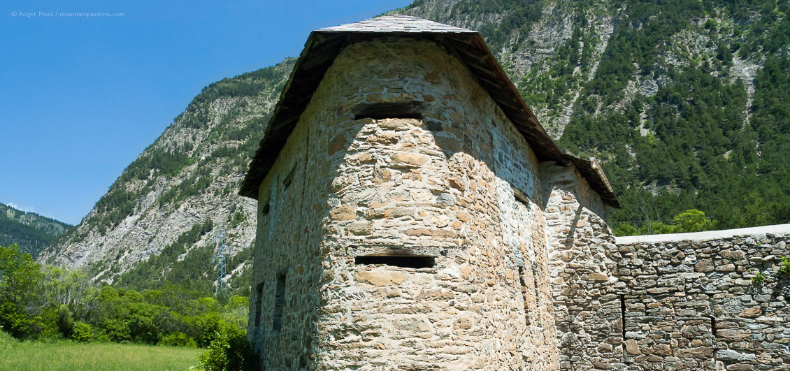
Next we pass Château Queyras, whose medieval fortress was conceived in response to repeated incursions by pillaging bands up from Provence. The impressive outline visible from the roadside today dates from much later, however, reflecting military engineer Vauban’s massive campaign of works during the 17th Century to strengthen the line of defences sited along the vulnerable frontier with Italy.
Through tunnels and gorges
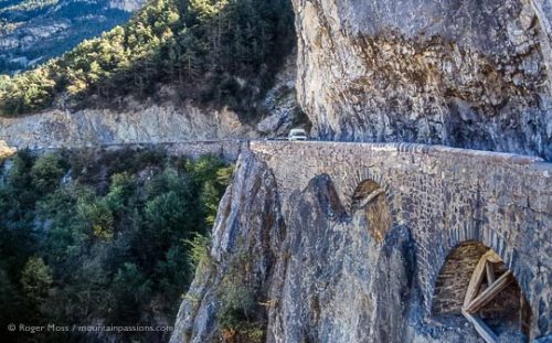
From here things close in for the Corniche-style run through the Combe du Queyras and Gorges du Guil, where a small lay-by provides an opportunity to pause and look back at the narrow route snaking through dark tunnels and swerving around rocky outcrops along the sides of a deep canyon. The tunnels were cut back in 1949, opening up what was once a simple pack-mule track, substantial sections being cantilevered out from the sheer rock faces on massive stone arches. Here and there the engineers’ original timber formwork is still visible.
Beyond Guillestre, long celebrated for its October Foire des Bergers, begins another wayward ascent, this time past the Southern Alps ski resorts of Risoul and Vars, whose linked domain is known as le Forêt Blanche.
For us, though, it’s a startling vision of fiery golds and yellows, as whole mountainsides of larch woodland give their all in the late autumn sun. The effect, reflected in the shimmering waters of a small lake at the roadside, is like having been suddenly transported to the Canadian Rockies. Nearby stands another Réfuge Napoléon.
Over the ‘new’ Col…
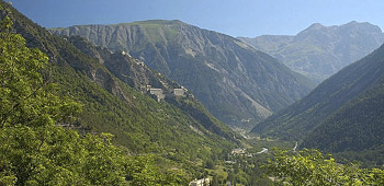
The climb to the Col de Vars (2109m) is relatively gentle, unlike that of its wilder predecessor, the Col du Parpaillon, and is followed by an exhilarating hairpin run down past the fort known as the Redoute de Berwick and the picture postcard village of Saint-Paul-sur-Ubaye. The military theme continues under the detached gaze of the vast Fort de Tournoux, constructed between 1843 and 1890 high above the point at which the river valley of the Ubaye is joined by that of the Ubayette.
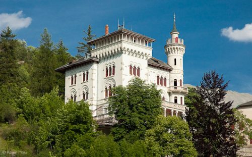
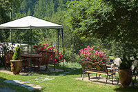
Pressing on past the elegant architecture around Jausiers we reach Barcelonnette, a remarkable town whose truly unique story is told in the Musée de la Vallée, housed in the Villa la Sapinière.
Overlooking the valley is the ski station of Pra-Loup, while the Route continues into the Gorges du Bachelard. It’s a tight squeeze, and was a key stage in the creation of the Route when it opened (unsurfaced) to motorists in 1913. The scenery finally softens and the valley begins to broaden near Fours-Saint-Laurent, before the ascent to the Col de la Cayolle (2327m). It was close to this spot in 1953 that an Air France Lockheed Constellation airliner en route from Paris Orly to Saigon crashed into Mont Cemet at 2800m while descending to Nice. All aboard perished, including composer René Herbin and concert violinist Jacques Thibaud (whose 1720 Stradivarius violin was also destroyed). 
Click link to follow Route des Grandes Alpes IV


Origins of the Route
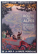
The Route des Alpes, as it was originally known, was conceived by the Touring Club de France in 1911, incorporating the spectacular high-altitude roads originally constructed to provide military access to fortifications protecting the Franco-Italian frontier.
Post-WWI technical improvements in braking and handling spurred a growth in private car sales, and during the 1920s the Route soon became one of Europe’s most celebrated touring itineraries. Early coach operators began offering excursions to high passes like Galibier and Lauteret, where hotels and restaurants soon opened to cater for early tourists.
The Route was finally completed in July 1937, with the opening of the 2770m Col de l’Iséran, the highest surfaced pass in Europe.
Useful addresses
Maps and Route Information
Despite the distinctive Route des Grandes Alpes signage, following the Route requires care. The dedicated IGN touring map will keep you on track, while the Route des Grandes Alpes (Ed. Gallimard) makes a highly informative travelling companion.
When is the Route open?
The website Cols Cyclisme publishes live information indicating the state of the Cols. The Info Route 05 website gives up to the minute information on the state of cols in the Hautes-Alpes.
Practical Guide
This website details a selection of scenic routes, trip ideas and accommodation plus some useful practical guides incluidng where you can charge your electric bike.
Places to Visit
 Musée de la Vallée à Barcelonnette
Avenue de la libération
04400 Barcelonnette
Tel. +33(0)4 92 81 27 15
Open all year except mid Nov-Dec, hours vary. Tarif Adults €3,30.
Take advantage of a guided tour if you can (Tuesday and Thursday in the summer), because the museum tells a remarkable story. Not only does it portray creatively the traditions of mountain life, but it also explains the fascinating tale of the Arnaud brothers, who left the valley in 1821 to seek their fortune in South America. Their legacy has made the valley what it is today and will surprise anyone who hears the tale.
Fortifications...
Tournoux, Roche-La-Croix, St Ours Haut and la Redoute de Berwick.
A mountainous crossroads of great alpine routes, and frontier between Provence and Piémont, the Vallée de l’Ubaye possesses remarkable traces of its military history, both on its peaks and at the confluence of its rivers. Guided visits to the sites run from mid-June to mid-September. See Tourist Office website for details.
Festival Time
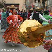
The Vallée de l'Ubaye hosts three main festivals every year - Le Festival des Enfants du Jazz in mid-July, the Fêtes Latino-Mexicaines every August and a classical music festival at the end of the summer. See Tourist Office website for programme details and ticket reservations.
Where to stay
Maison d’Hôtes Les Méans
Méolans Revel
Tel: +33 (0)6 19 25 93 45
Unwind in peaceful surroundings and comfortable accommodation with mountain and valley views. Breakfasts are a feast of local and home-made produce served in a stone-vaulted dining room.
Maison d'Hôtes Les Zélés
Hameau de Maljasset
St-Paul s/Ubaye
Tel: +33(0)4 92 84 37 64
If you really want to get away from it all, enjoy hiking, cycling and wildlife, this is the place. Picnic baskets are available, and dinner consists of dishes prepared from fresh local produce.
Food and Drink
Local Produce
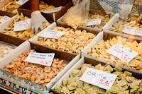
Ubayenne specialities include ravioli with fillings as varied as ortie (nettle), jambon cru with parmesan or fleur de courgette. Savoury tarts, particularly spinach, or potato and mushroom, also provide plenty of choice for vegetarians. Look out for local cheeses, freshwater trout, and the Alpine liqueur génépy. Market days are Wednesday and Saturday mornings.
La Maison de produits de Pays
04850 Jausiers
Tel: +33 (0)4 92 84 63 88
We defy anyone to go in this shop and come out empty-handed. All the products are made by artisans and producers in the Vallée de l’Ubaye. It’s particularly notable for honey from Alpine flowers and lavender, jam from the sweetest fruit you’ve ever tasted, and for a vast range of charcuterie and dairy produce. There are also crafts, pottery and leather goods. Products are also available by mail order.
La Poivre d’âne
49 rue Manuel
04400 Barcelonnette
Tel: +33 (0)4 92 81 48 67
Situated on the main street, the Poivre d’âne has several small dining rooms and in summer you can dine in the garden too. We sat near a lovely open fire, and after a long day’s skiing the Espace Lumière, were ready for our delicious meal. We started with the home-made soup followed by Bar Sauvage (23€) and Saumon à l’Oseille (18€) both served with potato and onion rosti, and seasonal vegetables.
If you’re skiing thenBarcelonnette (15 minutes’ drive from Pra Loup) is a fascinating town and well worth visiting during your stay.
Advertisement


